Reality Twin
Bring your digital twin to the next level
A RealityTwin is a digital version of a physical space, designed to help you monitor, plan, and optimize.
Acting as a digital-physical gateway, our twins emulate real-world scenarios incorporating weather, time, physics and other measured data.
What is the difference between a digital twin and a RealityTwin?
RealityTwins go beyond traditional digital twins by offering a seamless blend of realism and functionality. These lifelike replicas are designed to be interactive, allowing you to explore every detail of your real-world location in the digital space. But RealityTwins are more than just visual tools—they’re powerful management platforms. With features like real-time data integration, predictive analytics, and customizable dashboards, RealityTwins give you the tools you need to optimize, analyze, and visualize your operations like never before.


Data you can trust
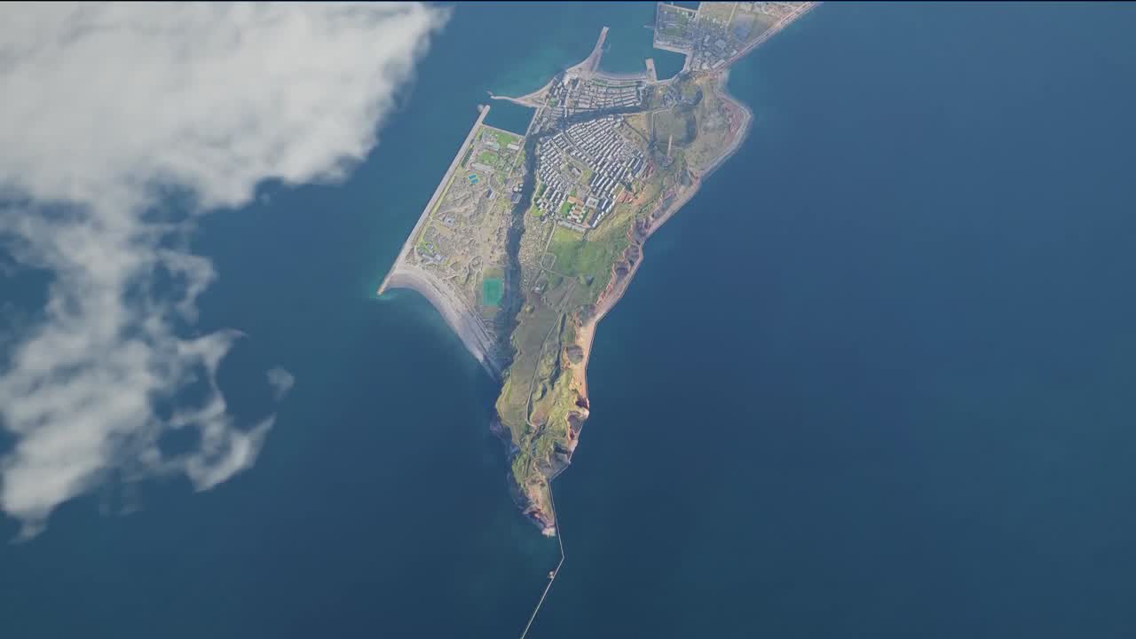
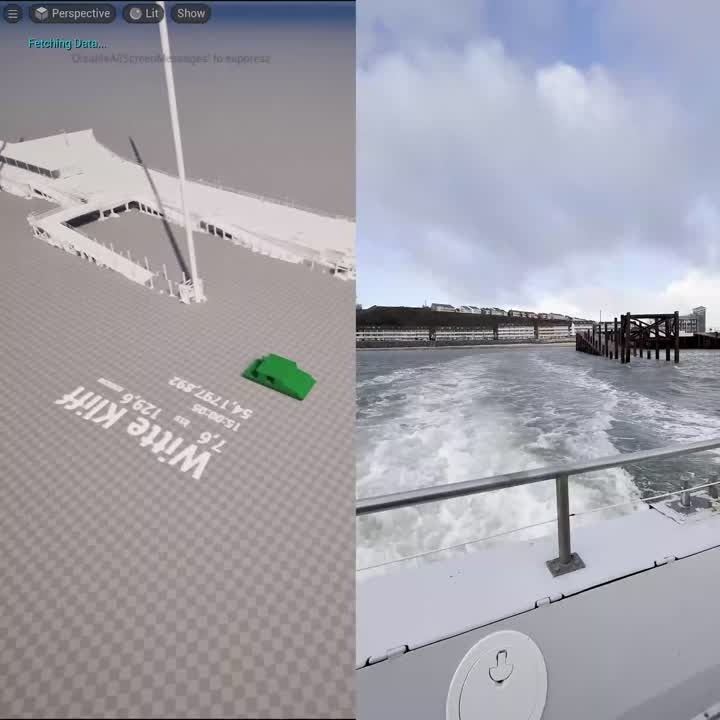
For all of our RealityTwins, we use collectlidar, photogrammetry, gaussian splatting, and build our RealityTwins in direct relation to satellite data to ensure maximum data accuracy.
The specified numbers were obtained on our most recent RealityTwin by comparing the professionally measured distance between two most distant Ground Control Points, with the virtual distance inside our software with a maximum 1.7 km horizontal and 60 m vertical distance.
Creating your RealityTwin
From just a concept to a powerful tool - we make sure that your RealityTwin fits your needs perfectly.


Built for performance
While we process thousands of Gigabytes to develop our RealityTwins, we always optimize them for superior performance, assuring smooth operation on any contemporary device, anytime, anywhere.
Developed in-house, just for you
Our RealityTwins mirror the uniqueness of your project's location and your specific requirements. That's why we create bespoke functionalities and build our own platforms, right here in-house.

Benefits
Elevate your project with stunning renderings that do more than showcase an image - they narrate a compelling story that taps into the heart of human psychology. Uncover the extraordinary psychological benefits:
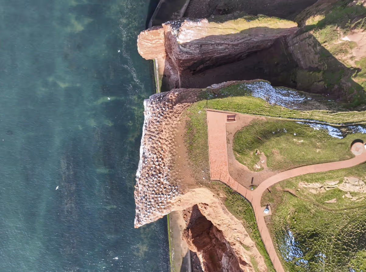
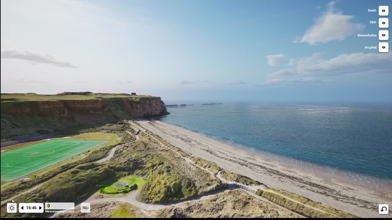
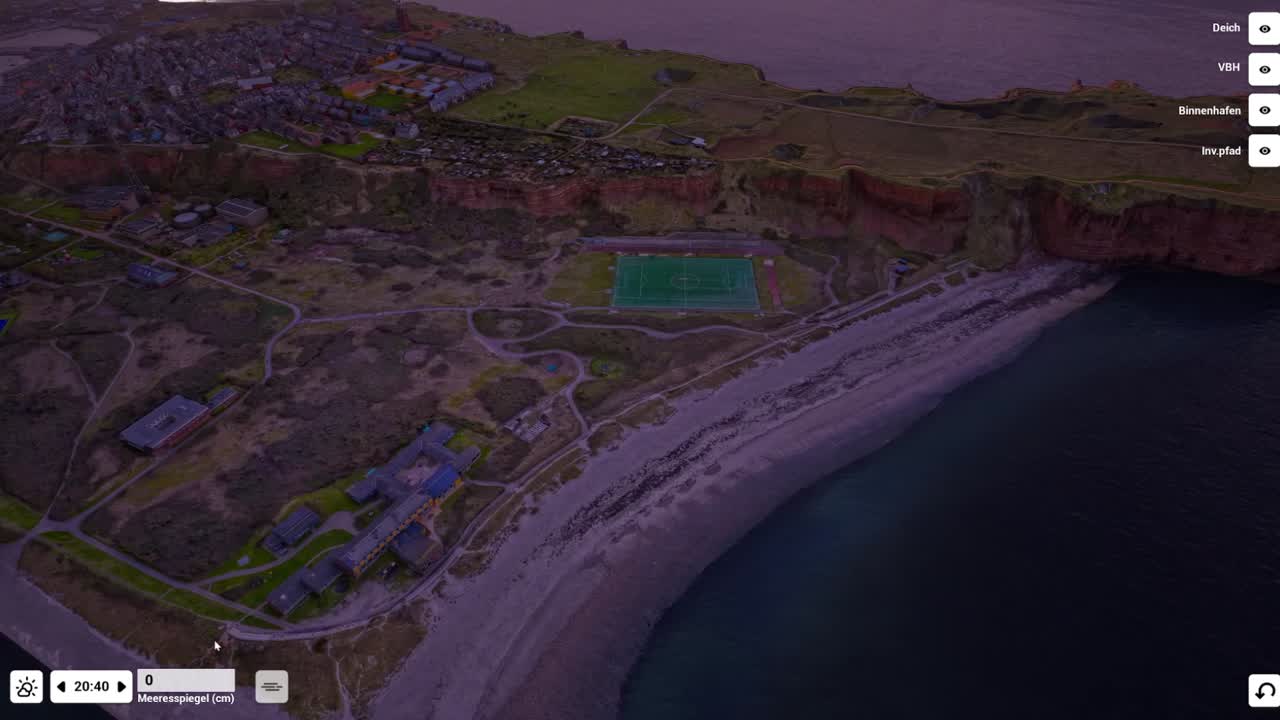
A Map That Lives
RealityTwins provide a fully interactive, real-world view—like a live helicopter hovering over a location 24/7. Users can explore places from every angle with unmatched accuracy.
Built for Your Location
Unlike generic mapping solutions, RealityTwins capture unique details, layouts, and characteristics with precision. Every model is a faithful digital twin, tailored to reflect reality as it truly is.
A Snapshot of Reality
No Photoshop, no artificial enhancements—just an unfiltered and true-to-life snapshot of any location. RealityTwins offer an accurate reference for your project.
Rich Data & Insights
More than just a visual tool, RealityTwins integrate detailed geospatial data, infrastructure metrics, and historical records. This makes them a valuable resource for smarter decision-making.
Multiple Layers
RealityTwins go beyond visuals, allowing for overlays, annotations, live data feeds, and historical comparisons. Users can interact with multiple layers of information tailored to their needs.
Always Evolving
Whether it’s a single building or an entire city, RealityTwins scale effortlessly. With uninterrupted systems, your projects can be updated quickly, keeping them as dynamic as the real world.
Use Cases
Discover how our RealityTwins can enhance your projects

Offshore Wind
- Monitor turbine performance in real time.
- Predict maintenance needs to reduce downtime.
- Visualize energy output and optimize operations.
- Enhance safety with detailed, interactive models.

Infrastructure
- Visualize urban development and transportation
- Simulate traffic flow and utility networks for planning.
- Monitor project progress and optimize workflows.
- Engage stakeholders with interactive models
Tourism
- Build interactive maps to explore destinations.
- Showcase hotels, attractions, and landmarks in detail.
- Attract tourists and boost bookings.
- Create immersive experiences for your location

Ski Resorts
- Track snow conditions and manage slopes efficiently.
- Provide interactive maps for guests to navigate
- Plan infrastructure upgrades with digital models.
- Enhance safety by monitoring traffic in real time.
Live Weather
Bring your environment to life. Our RealityTwins® can simulate a full range of weather conditions, from clear skies to rain and fog. By connecting to live data APIs, the twin can even reflect the current real-world weather, providing an unparalleled level of realism for operational planning and simulations.
Accurate Sun & Shadow Analysis
Make decisions with certainty. The RealityTwin® accurately simulates the sun's position and resulting shadows for any hour of any day of the year. This essential feature allows you to conduct precise solar studies for energy planning, assess the visual impact of new construction, and optimize the placement of assets based on real-world lighting conditions.
Live Data & IoT Integration
Transform your twin from a static model into a live operational dashboard. By integrating real-time data from IoT sensors, such as AIS trackers for ships, you can visualize the movement and status of real-world assets directly within the 3D environment. This capability is critical for logistics planning, traffic analysis, and gaining a true, up-to-the-second understanding of your operations.
Our all in one solution
Whatever we do isn't just for one-time use — it's templates, ready for future adaptation.
We don't just do simple image composition; we build an entire visual ecosystem. So, you're not just paying for a single rendering, but for a robust, versatile visual toolkit that can be expanded upon for any purpose.

Our other skillsets
RealityTwins
Live, data-enriched digital replicas of real-world locations
.svg)

